|
THE SHELTOWEE TRACE NATIONAL RECEREATION TRAIL(280 Miles in 12 Days)July 2007
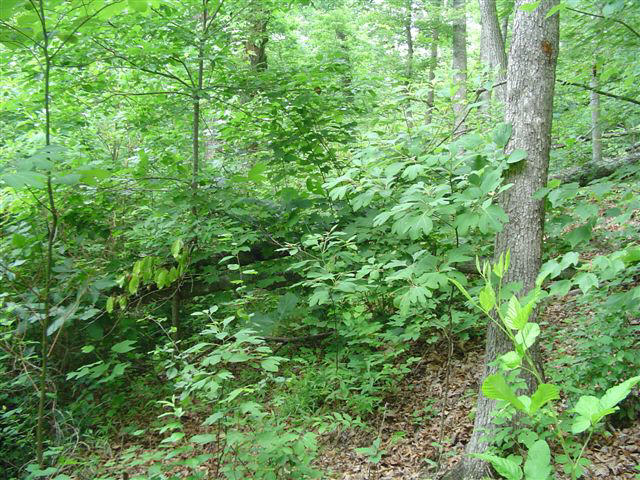
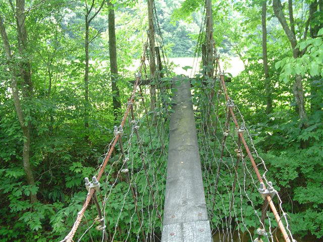
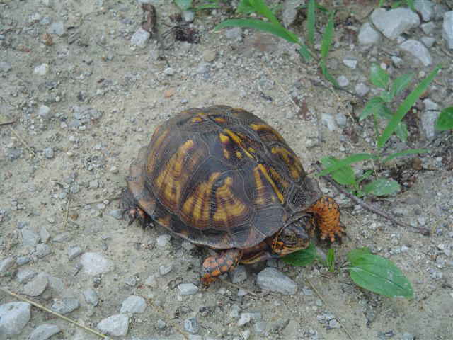
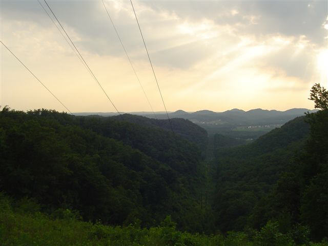
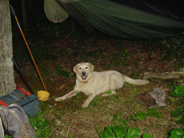
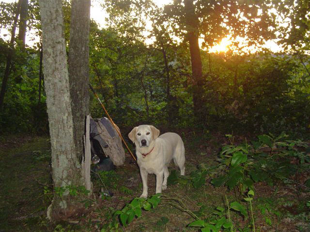
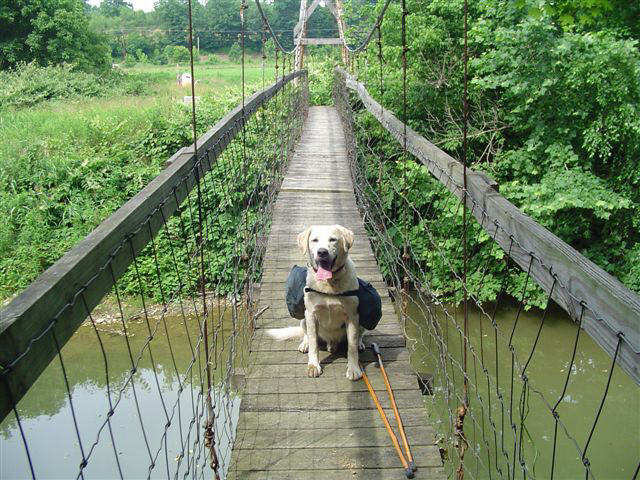
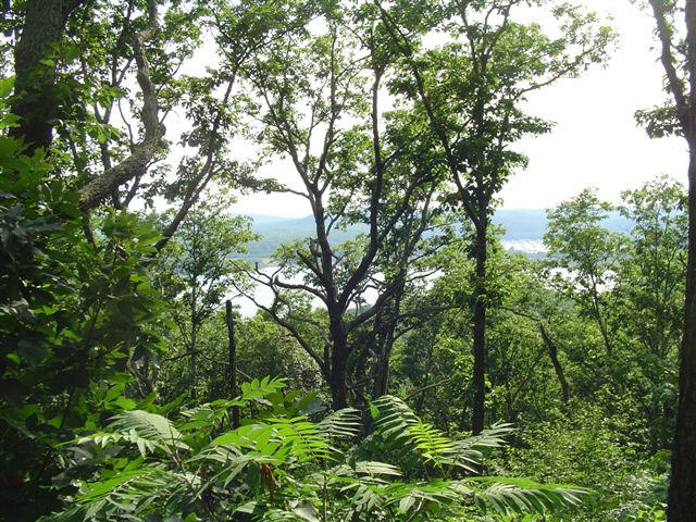
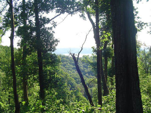
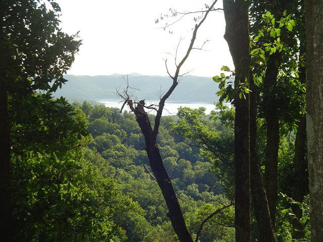
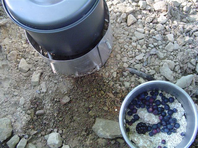
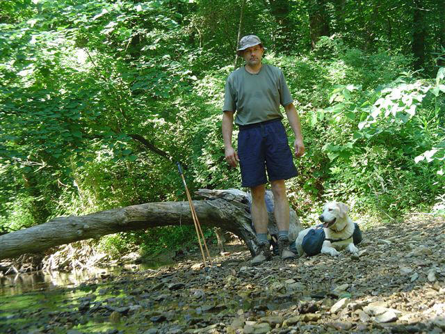
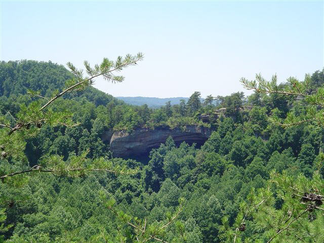
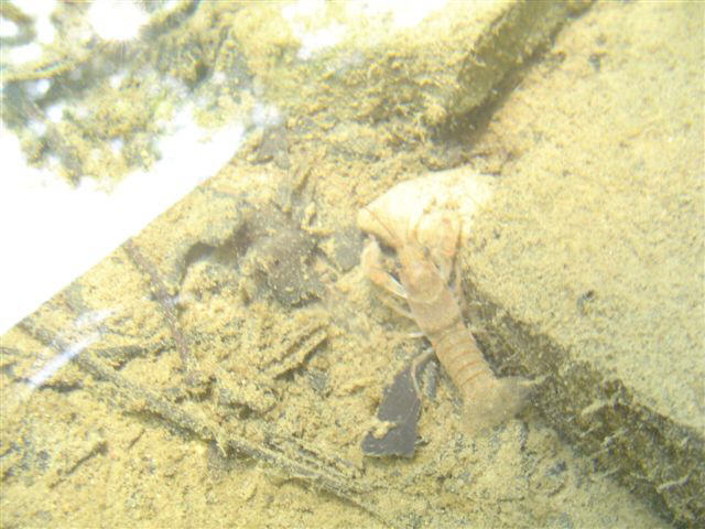
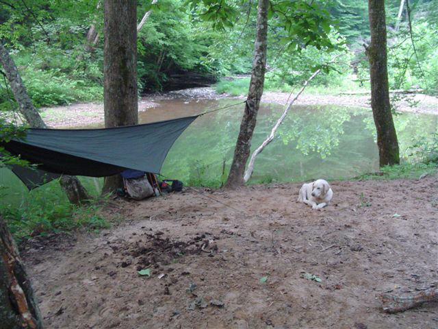
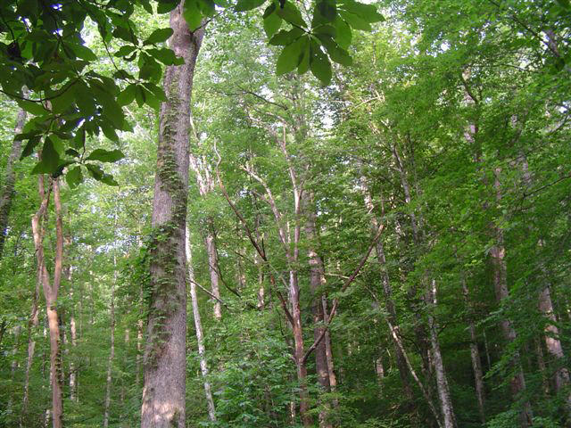
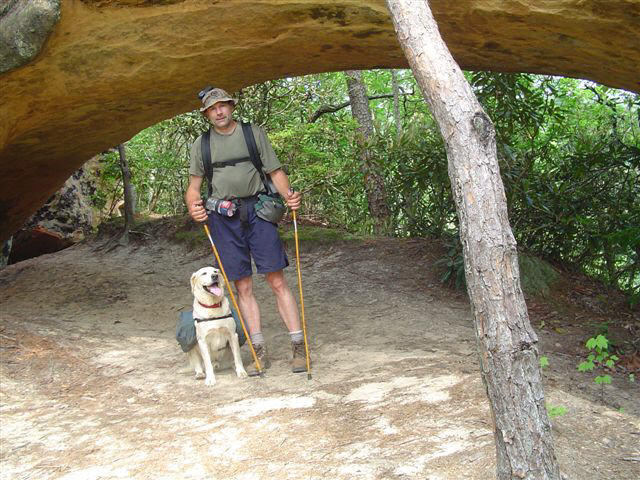
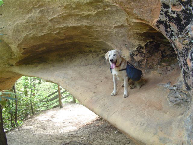
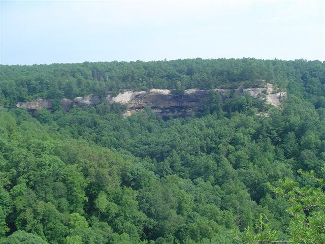
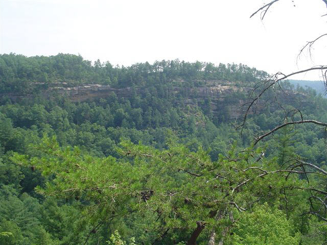
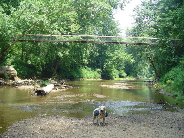
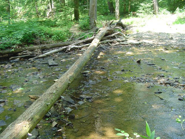
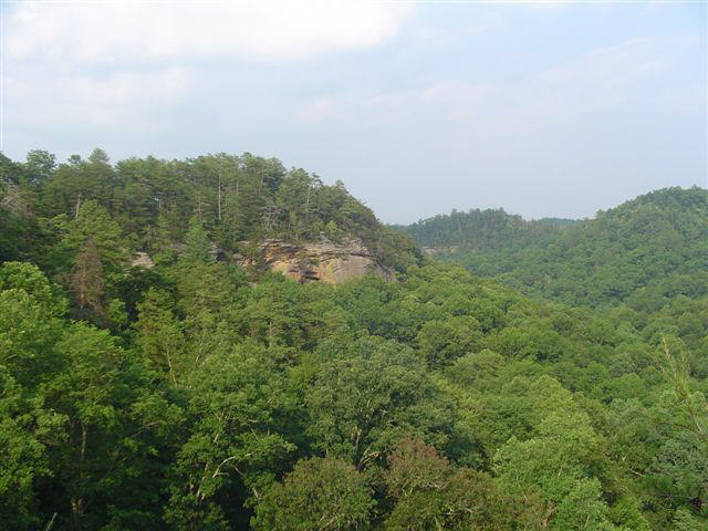
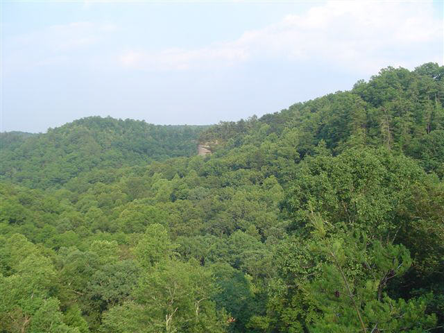
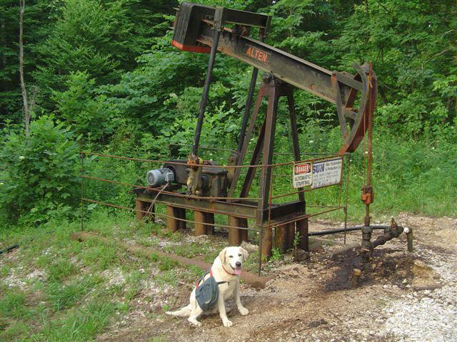
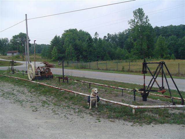
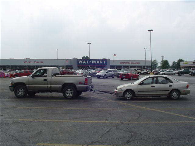
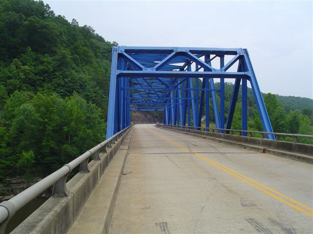
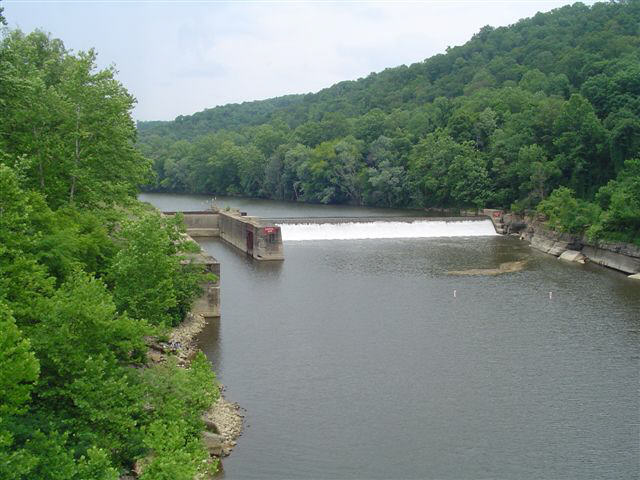
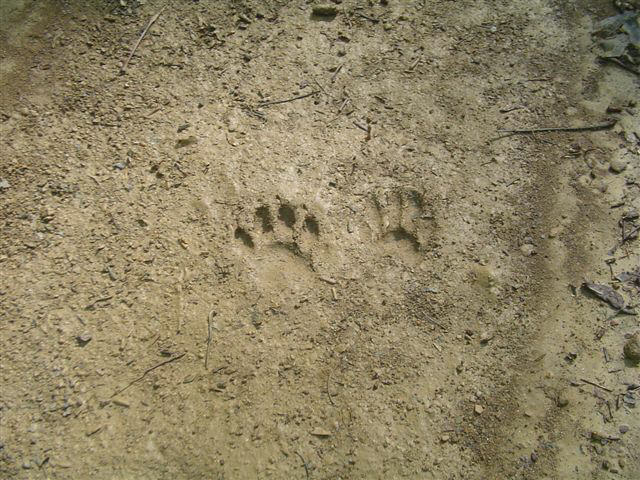
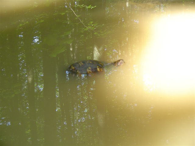
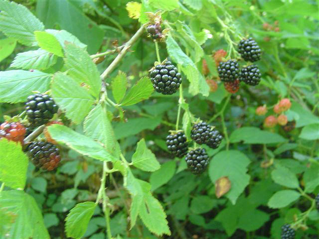
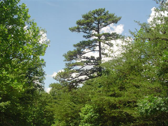
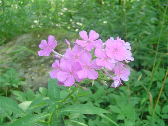
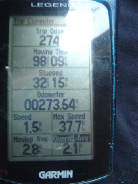
The Sheltowee Trace is a 280-mile national recreation trail that starts about 15 miles North of Morehead Kentucky and ends at Pickett State Park in Tennessee. The trail was named after Daniel Boone who was given the name “Sheltowee” meaning big turtle by the Shawnee war chief Blackfish when Daniel was captured and then adopted as a son by the chief. The trail follows a North-South route and includes parts of the Wilderness Road and Warrior’s Path. The Wilderness Road was originally cut by Boone to bring settlers into Kan-tuk-kee while the American Colonies were still part of Great Britain. The Warrior’s Path was used for centuries by the native peoples of this region to travel to and from this lush hunting ground. The trail passes Cave Run Lake, Clifty Wilderness, Red River Gorge, Kentucky River, Laurel Lake, Cumberland Falls, Rock Creek Wild River and Pickett State Park in Tennessee. My son Ryan and I section hiked the Sheltowee from 1998 to 2001 and ever since finishing that trek I have dreamed of the day that I would thru-hike the entire trail. Since January I have logged over 200 trail miles preparing for the “big one”. I have tweaked my gear to drop pack weight even building my own pack because I could not find a frame pack that was light enough to suit me. I made a lot of my own clothing too including pants by attaching waterproof heavy-duty leggings to swimming trunks with Velcro. In 1998 my pack alone weighed over 50 pounds. I didn’t even weigh the clothes I wore. On this trek I had about 34 pounds “skin out” weight. The clothing I wore plus poles and the GPS receiver was about 6 pounds and the pack was about 27 pounds. About 15 pounds of that pack weight was food and water that diminished as I hiked. I wore a pair of boots, two pair of Smart-Wool socks, synthetic underwear, synthetic t-shirt and my homemade convertible pants. I made the leggings just for the first section because I figured if it was not well maintained I might have to go through some briars. I also wore a homemade boonie style hat with a piece of Velcro sewn on to attach the GPS receiver. Day 1 Saturday 6/30/07On Saturday June 30th 2007 my yellow lab Jack and I left our home in Perryville KY at 5:22am. I was driving my 99 Silverado and had my 95 Protégé in tow. We left the truck at the Wal-Mart parking lot in Morehead and traveled on to the Northern terminus via the Protégé. The first part of our hike was so short due to the adverse trail conditions. The first 14 miles of the trail have been officially closed for several years and have not been maintained. At 7:53am, full of vim and vigor Jack and I started our trek. With my heavy-duty leggings in place, a machete in one hand and a trekking pole in the other, I thought we were ready for anything. That first day however almost finished us both. About 4 miles of the first 14 are a total bushwhack through saw briars and undergrowth that kept my machete moving until my arms were cramping from over use. I had not conditioned my arms for the machete at all. Poor Jack was down at ground level and had to endure more than I. He followed my every step and when we finally reached the forest road just North of I-64 we were both elated. The whole reason we started at the Northern terminus was to get this dreaded part done while we were fresh. The rest of the first day was basically a seven-mile road walk. We made a dry camp at 8:03pm on a high ridge overlooking the outskirts of Morehead. Data for day one: 21.5 trail miles hiked, 0.7 extra miles hiked, moving time 8:59, stopped time 3:08, average moving speed 2.4 mph, total average speed 1.8 mph. Day 2 Sunday 7/1/07We broke camp at 6:35am while witnessing a beautiful sunrise from high on the ridge. Down to less than a ½ liter of water after dry camping, there would be no breakfast until we reached Morehead. If you are low on water, do not eat because your body uses water to process the food and you become thirstier than before. We arrived back to the truck at 8:42am. After a breakfast bowl from Hardee’s, we moved the car to Heidelberg, refilled our packs and were back on the trail (highway) at 1:59pm. The first 6.3 miles was all asphalt and it was hot on Jack’s feet. By the end of the day I knew he would not be able to make the whole trek. He had a noticeable limp on his front left leg. I lightened his pack to just his food, bowl and water. The highlight of the day was Cave Run Lake. From the first lake views several miles away to the time I made the splash, I was anticipating the refreshing water. Both Jack and I took a long swim and relaxed in the water. This is the first time I have ever seen Jack swim. Rare for a lab but Jack is water shy and avoids it most of the time. We could have swum all day but we had to get into the woods and find a camping spot before dark. We hiked a few miles before refilling our water at Hog Creek. About 9:15pm we found a campsite at the junction to White Sulfur horse camp. Data for day two: 20.5 trail miles hiked, 0.0 extra miles hiked, moving time 6:55, stopped time 2:01, average moving speed 3.0 mph, total average speed 2.3 mph. Day 3 Monday 7/2/07We left our cozy campsite at 7:22am and I had a hankering for some blackberries to put in my oatmeal. After several miles and only one blackberry, I spooked three turkeys that were standing in the trail. To my surprise they were feeding on ripe blueberries. I stopped long enough to harvest a small bag to flavor my breakfast. I probably should have felt guilty for stealing the turkey’s breakfast but I didn’t. One little trick I do is to only heat water in the pot and prepare my food in the stainless steel cup. After my breakfast of oatmeal or hot granola, I then make a cup of tea also in the cup and then use the tea bag like a dishrag to clean the cup. When breakfast is over the dishes are done. If you can tolerate a little oatmeal texture to your tea, you can save time and water. The special treat of blueberry oatmeal was great! I grazed on blackberries and raspberries the whole trip but this was the only ripe blueberries that I found. We ate lunch at Clear Creek. This is the first water since Hog Creek over 6 miles ago so we pumped our water bottles full only to discover a spigot at Clear Creek trail head just over the next small hill. At approximately 51 trail miles the ridge top views are spectacular reminding me of Auxier Ridge in Red River Gorge. The highlight of the day was when a hawk soared by at eye level while we were walking on the ridge top. While road walking on KY77, I stopped to talk to some people sitting on their front porch and they warned me that bears had been sighted in the area. This was news to me but I had been hanging my food since day one and would continue to use good camp hygiene. We pushed a little to make camp at Gladie Creek (67.8 trail miles) at 9:06pm. The water was deep enough for a swim and I took advantage of it for a much needed bath. I could still vividly remember when my son and I camped at this exact location in 2000. We awoke for a morning swim and had a large fawn run through the creek towards us until finally turning about face at about 20 feet away and fleeing. We were both awe struck at the sight and just watched it all unfold. No such encounter on this trip but I noted that Jack was asleep before I finished my bath. Normally a big eater he did not eat his supper and just seemed spent. Data for day three: 25.8 trail miles hiked, 0.1 extra miles hiked, moving time 9:11, stopped time 3:45, average moving speed 2.8 mph, total average speed 2.0 mph. Day 4 Tuesday 7/3/07I awoke at 6:30am but I let Jack sleep in to hopefully heal up for the day's hike. We broke camp at 9:36am and continued our Southerly trek. The trails in this part of the Clifty Wilderness are in great shape and there are many established campsites. It is obvious that this section gets more use than any point up to now. At 70.7 trail miles we encounter Natural Arch. This arch made for a prime photo opportunity. I was not carrying a tripod due to weight restrictions so I noticed several of my photos were as skewed as the objects I used to rest the camera on. We stopped for lunch and water pumping under the suspension bridge spanning the Red River. A quick push up the Rough Trail and we are out of the Red River Gorge. I passed a father and son hiking into the gorge as I was leaving it and it caused me to reflect back to 2000 when Ryan and I hiked this section. I hope they had as much fun as we did on our hikes. When I arrived at Natural Bridge State Park there were several signs stating that Jack was not welcome on the trails inside the park. Not about to turn around now, Jack and I marched up hill toward the arch at a rapid pace. We did not go to the arch itself for fear of being sited but turned onto Sand Gap Trail and continued south. We made an early dry camp at 7:19pm beside a gravel forest service road. To press on would take us onto private property and thus no place to camp. Several vehicles traversed the road during the night. The first was a hunter in an old Ford truck complete with dog box. I don’t know any season that is in on July 3rd but maybe that doesn’t matter as much there. I slept easy because I made my camp some distance from the road and therefore was not noticed. The day was less rushed than previous days and Jack seemed to heal up a bit. Data for day four: 18.2 trail miles hiked, 0.9 extra miles hiked, moving time 7:11, stopped time 2:12, average moving speed 2.5 mph, total average speed 1.9 mph. Day 5 Wednesday 7/4/07Happy birthday America! To be born free is a privilege to die free is an awesome responsibility (Author unknown). We broke camp at 6:46am, again low on water, breakfast had to wait. We refilled our water bottles at the Church of the Standing Rock’s spigot and continued our road trek past the oil wells of Lee County. Only a few of them were pumping. I found this odd with crude oil prices at all time highs. From our previous hikes I remembered a country store on this section but was unable to find it during the pre-hike so I assumed that it was out of business. One of the highlights of the day was stumbling onto May’s Food mart, Restaurant and Deli. While Johnnie Anne Robbins made me a big deli sandwich and Moes Robbins watched, I checked out their inventory and found to my surprise everything a thru- hiker would need to re-stock a pack. The ham and cheese sandwich weighed about a pound and she threw in some “scraps” for Jack. The scraps were really just extra slices of ham. After I left the store, I was disappointed to find the trail Ryan and I followed in 1999 had been closed and replaced by a nine-mile pavement walk all the way to the Heidelberg Bridge. According to a man on his front porch, the owner of Lago Linda’s Hide-a-Way moved in from West Virginia and had the trail closed. The other highlight of the day was meeting Hxxxxxxxx(name omitted on purpose). The three-great grandson of Daniel Boone lives on the trace but was not aware that it was named after his late relative. He explained that Phillip xxxx married Daniel’s youngest daughter Rebecca Boone. Their son was Nathan Boone xxxx and his son was Benjamin Turner xxxx and his son was Robert Cole xxxx and his son was Hxxxxxxxx. Hxxxxxxxx now 87 years young came outside to see what his dog was barking at only to have me engage him in a thirty minute conversation about everything from genealogy, career advice, history of the 1917 Lee County oil boom to current politics. One thing I do is try to engage everyone I meet in some sort of conversation. Sometimes it’s a dud but this time it was pure gold. I took Hxxxxxxxx’s photo with Jack and finished my road walk to Heidelberg. Arriving back to the car at 2:59pm, we drove back to Morehead, hooked up the tow bar and took Jack home. Data for day five: 20.2 trail miles hiked, 1.1 extra miles hiked, moving time 6:24, stopped time 1:39, average moving speed 3.2 mph, total average speed 2.6 mph. Day 6 Thursday 7/5/07I left the house at 9:42am. With steady rain falling I was not in a hurry to get started. I dropped my truck at I-75 and drove the car to Heidelberg. I was back on the trail at 2:23pm and enduring another long road walk. Due to the hot weather, I did add another liter to my water supply (four liters total) so I would not have to stop as often to pump water. Data for day six: 18.6 trail miles hiked, 0.0 extra miles hiked, moving time 6:29, stopped time 1:02, average moving speed 2.9 mph, total average speed 2.5 mph. Day 7 Friday 7/6/07I broke camp at 6:38am and for the first time saw just how pitiful a camp spot I had chosen in the dark. The hill was at a 30+ degree slope. It was covered with poison ivy, deer ticks, rocks and boulders everywhere. I had the water to eat breakfast here but still moved on due to the tick situation. Millions of deer ticks were marching up my legs as I took down the hammock and bear bag. Once back on the actual trail, I stopped and reapplied my deet in a liberal fashion. This day I passed the half waypoint of the trail and I had a quiet little party in my head. The highlight of the day however was Horse Lick Creek. You only have to ford it three times but due to my haste to find the trail, I forded a couple extra times. I think I figured out that I’m a Chevy man because fords are too much trouble. Still the Horse Lick Creek area was very nice. Nearing dark I met Scott and Sheri Miller riding their ATV and we spoke at length. We figured out that Sheri’s dad’s niece worked for me at my day job. They seemed most interested in why I would attempt a 280-mile trek across Kentucky. Coincidentally I had been wondering that too. At 8:40pm I made camp after the last ford of Horse Lick Creek. I wanted to get across the creek because several four wheelers were playing on the other side and as I suspected they kept going into the night. Data for day seven: 25.2 trail miles hiked, 1.3 extra miles hiked, moving time 8:37, stopped time 3:29, average moving speed 2.9 mph, total average speed 2.1 mph. Day 8 Saturday 7/7/07I broke camp at 7:17am and hiked out to the riveted bridge over the Rockcastle River (trail mile 156.0) on hwy 490. Just before the bridge while road hiking hwy 89 a large 8-point buck, still in velvet, jumped out in front of me and then in one leap was across the road and he quickly disappeared. If I had the camera in my hand, I could not have snapped the picture in the short time he was in sight. I had also spooked a flock of turkeys off their roost at daybreak near my campsite. This whole trail is filled with wildlife of every sort. I especially enjoyed having so many whip-or-wills serenade me as I drifted off to sleep each night and the songbirds to wake me the next morning. When I arrived at the Wildcat civil war memorial monument, I met a volunteer named Maxine Cass and she gave me an overview of the monument and how private money and grants were used to preserve this historical area. We discovered that we had a couple of mutual friends who helped her establish, fund and dedicate the memorial. After leaving camp Wildcat, I traveled a short distance down the Wilderness Road and stopped to talk to Jonas Fortney 61 years young whose grandfather, with the same name, built the house in 1894. Mr. Forney said that this little dirt road was at one time the major North South corridor. The old slave house stood just behind his house and housed the workers who kept the road passable. He said one section was called corduroy because it had so many logs laid across it to keep wagons from sinking that it looked like the corduroy fabric. He noted that back in the day the stagecoach came right through here too. Jonas keeps an immaculate garden and I remember admiring it when I last passed by in 1999. I arrived at I-75 and my truck (trail mile 168.7) at 2:13pm. I drove to Heidelberg hooked up the car and towed it to Pickett State Park in Tennessee then drove the car back to I-75. I did not get back on the trail until 11:59pm. Of course hiking in the dark is not new to me but every time I do it, I know I am messing up. I left I-75 in the dark and was grandly bewildered within 5 miles. I was using my headlamp but due to the ATV damage and the fact that all of my previous hikes through this section were traveling in the opposite direction, I was still having trouble finding the trail markers. I did stumble onto three guys in highly customized jeeps enjoying a malt beverage or ten. They were parked directly on the trail with vehicles facing every which way. As I approached them at nearly 2am, I heard one of them refer to my approaching headlamp by saying, “What to Hxxx is that”. I spoke with them briefly and continued in vain trying to find trail markers. At 3:21am I finally gave up on reaching Hawk Creek and made dry camp on the side of a hill. Lesson learned for at least the tenth time: STOP HIKING IN THE DARK! Data for day eight: 22.6 trail miles hiked, 3.8 extra miles hiked, moving time 7:26, stopped time 1:30, average moving speed 3.0 mph, total average speed 2.5 mph. Day 9 Sunday 7/8/07 After a breakfast of oatmeal with granola, I broke camp at 7:26am and began hiking. I passed the great campsite at Hawk Creek that I had been trying to reach the night before. It was just as nice as I had remembered from my May hike. Later while picking my way through a fallen pine tree between I-75 and US80, my bootlace caught and sent me careening headfirst to the path. Normally I have my sticks to catch me but I had pushed them through ahead of me so I could navigate the narrow passage with my hands free. I think the lack of sleep contributed to this fall and several bewilderments soon to come. A few miles after I crossed highway 80, I came upon the incorrect trail marker that had caused Jack and I to hike an extra three pavement miles in May. The marker was correct at one time but due to the continually changing trail route, it was now an evil bewilderer. I know there is no such word but I can still remember the look on Jack’s face as we retraced our path in May. He doesn’t say much but sometimes his expressions speak volumes. I was able to relocate the aluminum trail marker to a more helpful position. (Another evil bewilderer slain thanks to a sharp rock and loose nails). I arrived at the Holley Bay Marina at 7:52pm. I was too late to enjoy the sirloin burger that they stop serving at 6:00pm so I ordered a large meat lovers pizza and a Dr. Pepper. It is always cause for celebration when you come across a store or someplace serving food on the trail because you did not have to carry it or cook it. After supper with the sun now gone for the day, I had to find a place to call home for the night. My knee had been talking to me most of the day and I knew if I could find a good place by the lake that I could soak it. After about a mile, I found a spot not quite legal but otherwise perfect. Right on the point of a finger pointing into the water with two trees just the right distance apart for my Hennessy, I made camp. During the night I heard voices so close I thought they were coming down the trail. As I began to prepare for company in the middle of the night…, I discovered it was bass fishermen in a boat working the bank and they did not notice me even though I was so close to them I could hear them breathing. Data for day nine: 26.0 trail miles hiked, 2.5 extra miles hiked, moving time 8:24, stopped time 2:33, average moving speed 3.1 mph, total average speed 2.4 mph. Day 10 Monday 7/9/07At 6:00am I awoke with a lake swim. The water was warmer than the ambient air temperature and felt great! I noticed that the lake seemed abandoned. I guess the lake is only busy on the weekends. At 7:02am I ate the last two pieces of pizza for breakfast and broke camp to start my daily trek. I started early to get a jump on the heat of the day. I noticed that I consume about 1 liter per 4 miles when the temps are under 90 and about twice amount that when it is over 90. At the mouth of Laurel boat ramp I paused to speak with an elderly gentleman who was walking to recover from heart surgery. He had a couple of aggressive dogs with him and said this is about the only flat spot around for him to exercise. He was intrigued with my endeavor and stated that 75 miles is not much to go. After we parted, I wondered if he had walked a lot in his younger years because to most people 75 miles is still a lengthy walk. Between Bark Camp shelter and Star Creek shelter I encountered a doe with a fawn nursing. I was able to get a photo by pretending not to see her and not making eye contact until I was ready to take the photo. Although I turned the flash off, she bolted when I took the photo. The doe ran ahead and the fawn ran into cover near the Cumberland River. When I reached Cumberland Falls I ordered a cheeseburger, fries, ice water and a milkshake from the snack bar. Several people there engaged me in conversation as to how far I had come and where I was going. I guess after 10 days of not shaving, barely bathing and washing my clothes in the rivers and lakes, I looked like I had a story to tell. One gentleman about 50 said he had been hiking in the Smokey’s but could only average about 14 miles per day. He said he was planning to do the Sheltowee next summer from hwy 60 to Pickett. Another interesting conversation was with an Amish young man and his family’s driver. The Amish guy was about 25 and in good shape but he could not understand why anyone would walk for recreation? After an extended lunch break, I filled my water bottles at the restroom sink and continued southward. Not long after leaving the falls, I received a taste of what was to come when it began to sprinkle rain. The rain only lasted a few minutes but was ironic that the thunder started as I stepped onto Thunderstruck Road. The rain was enough to make the grass wet and thus soak my boots. Even my trusty waterproof Timberlands will soak through if you walk in rain or wet grass long enough. As the daylight grew dim, I washed up at a small creek and found a spot to hang my hammock. My supper of noodles and chicken meat would almost empty my food sack. I took inventory and was glad to have hung a bear bag near hwy 27 only a few miles ahead. I recorded a whip-or-will only a few yards from my hammock serenading me to sleep. Data for day ten: 27.9 trail miles hiked, 0.0 extra miles hiked, moving time 10:18, stopped time 3:32, average moving speed 2.7 mph, total average speed 2.0 mph. Day 11 Tuesday 7/10/07At 5:53am I arose to the birds singing and was glad to see the rain was holding off for now. I hit the trail at 7:19am and made my way to hwy 27 and thus my food and water stash. The trails in this area are in much better shape because the horse people frequent them. I was glad to find my stash unmolested. I was a little worried that a raccoon may raid my food before I could retrieve it. When I stash food I do it in one of two ways. This time I hung the food in a bear bag about 15 feet off the ground and three feet below the hanging limb. In the past I have buried five-gallon metal buckets with tight sealing lids in the leaves. I always GPS mark the food stashes just for a double safety when trying to find them. I enjoyed a long breakfast stop right beside the hwy 27 trailhead. Incidentally this trailhead is where my catalytic converter was stolen in May. The rain set in about 2:00pm and started just as I was passing an old abandoned restroom near the Yahoo Falls turnoff so I held up there for an hour or so and when the rain slacked off I left the shelter. During another heavier rain I held up in a rock house and even made a lounge chair from the flat rocks inside. I eventually gave up on outlasting the rain and just kept moving. At trail mile 240 there is the Alum Ford trail shelter that we stayed in this spring when hiking with BSA Troop 71. Just before Yamacraw I met up with a lady that said she and her family had been camped on the river for eight weeks. They had two large 20x40 tarps pitched and have individual tents pitched under one tarp and the other tarp is used for the kitchen area. They just fish and live out of the river and the ones that have jobs work during the day. No rent, no utilities, no problem. Knowing that if I were going to encounter a bear, it would probably be south of Yamacraw, I was a little more on edge during this section. It was no comfort when I came across bear tracks in the mud at 248 trail miles or a pine tree with claw marks as high as seven feet at 250 trail miles. I passed the bear’s territory tree just as it was getting dark so I pressed on another mile before making camp in the more open area of hardwood forest. I purposely hung my food a little further from camp and more securely than other nights. It had been raining steady all afternoon so I was glad to get under the rain fly for supper and for eventually bedding down in the dry hammock. Data for day eleven: 24.3 trail miles hiked, 0.0 extra miles hiked, moving time 8:18, stopped time 5:36, average moving speed 2.9 mph, total average speed 1.8 mph. Day 12 Wednesday 7/11/07I hardly slept at all because as the rain continued through the night huge trees kept falling all around me. I had picked the campsite because it had very little cover and I could see through the big timber with my flashlight but I had not surveyed the area for dead standing trees other than the ones I tied the hammock to. At one point a big tree fell so close that it shook the entire hillside. There had been a short lull in the rain and the crash knocked all the droplets from the leaves. All total only six to eight trees fell but the possibility of being crushed kept me awake most of the night. I had a great breakfast of hot granola followed by my morning tea with cider. The rain continued most of the day. I had one close encounter when I was road walking on gravel and looked up just as a turkey looked up at me from about 10 feet away. He must have been deaf not to hear me coming but I guess the rain muffled my footsteps. Anyway he fled with great haste when he did see me. The trek from Divide Road to Great Meadow follows a small creek and due to the rain, I basically waded about a mile in six to eight inches of water. My boots were already soaked through so there was no use trying to avoid the water. My knee let me know that it was still not well so I stopped to soak it in Rock Creek and take a little swim in between rain showers. I put my driest three pairs of socks back on and started the last leg of my great adventure. I had added another pair of socks when my boots soaked through on day 11. I think the boots stretched or my feet shrunk but I could not keep my boots tight until I added the third pair of socks. I had been worried about the Rock Creek ford but when I reached the creek it was only slightly deeper than when I waded it in the spring. My boots were still wet so I just waded it boots and all. After a little sign confusion in Pickett State Park because none of the signage is for people coming from the north, I popped out at the trailhead on hwy 154 and was ecstatic to see my Silverado waiting to take me home. I retrieved my trash that I stashed at hwy 27 and then the car from I-75 before going home. What an adventure! Data for day twelve: 22.8 trail miles hiked, 0.7 extra miles hiked, moving time 8:58, stopped time 1:48, average moving speed 2.5 mph, total average speed 2.1 mph. Data for the whole trail: 273.6 trail miles hiked, 11.1 extra miles hiked, moving time 98:10, stopped time 32:15, average moving speed 2.8 mph, total average speed 2.1 mph. Note: this data is flawed due to the GPS receiver not being able to always find a satellite due to foliage. When it does finally find a satellite, it just adds the straight-line distance from the last track. On many occasions I looked at the GPS only to see that it could not find a satellite. This error subtracted many miles from the GPS mileage. The actual trail length is something more than 273.6 and I cannot doubt that Johnny Molloy’s 281.7 is correct. If he did the trip when the leaves were gone, his mileage would be closer than mine? Next time tips:
Update to trip report: All-in-all I am still glad I did it while I was able. Note on photos: |
|
|